
Map reader between lectures
You mainly use maps, documents and websites in different places around campus. Portability and having enough screen space are both worth considering.


A portable laptop with a screen that’s comfortable to read is often all you need to view neighbourhood maps between lectures. Choose the size based on how many map details and notes you want to see at once. If you’ll be editing maps locally, check the software requirements first: QGIS lists Windows and macOS among its supported operating systems, while Esri specifies Windows for ArcGIS Pro. If you want to draw directly on maps, also check that the exact 2-in-1 model works with your chosen pen.
You mainly use maps, documents and websites in different places around campus. Portability and having enough screen space are both worth considering.
You edit map layers or data. The software required for your assignment will help determine which operating system you need; Esri specifies Windows for ArcGIS Pro.
You want to mark routes or locations directly on a map, or add annotations. So, check that the exact laptop model supports your chosen pen.
Start with your main task: viewing maps has different requirements from running GIS software locally or taking notes on screen.
| What to consider | What to look for | Who should consider this? |
|---|---|---|
| Taking it with you and working between lectures | Compare the weight and screen size of the exact model. Also check charging options and ports. | If I often carry my laptop from one part of campus to another, I don’t want to carry unnecessary weight, but I still want to work comfortably. Around 31% of consumers say portability is their main purchasing concern. |
| Compatibility with mapping software | Find out which application and version your course uses. Check your laptop against the software requirements, including any required plug-ins and data sources. | If I need to edit map layers locally, I want to be sure the required application will work on my laptop. Around 31% of consumers prioritise software compatibility. |
| Reading map details | Check the screen size, resolution and panel type of the exact model. If possible, try viewing a map with its legend at that size. | If I want to see map details and the legend clearly, having a good overview matters more to me than choosing the smallest possible laptop. Around 23% of consumers give map readability top priority. |
| Adding annotations with a pen | Check that the exact model supports your preferred pen standard and whether a pen is included. | If I want to draw routes or locations directly on a map, I want to know that the pen I have in mind will actually work with my laptop. Around 15% of consumers prioritise pen annotation. |
Viewing a map in a browser is different from installing desktop GIS software for an assignment. QGIS lists several supported operating systems, while Esri specifies Windows for ArcGIS Pro.
Before buying, ask which application and version your course requires, then check the relevant system requirements.
A touchscreen alone doesn’t confirm that the device supports the active pen you want to use.
Check which pen standard the exact model supports and whether a compatible pen is included.
Manufacturers may quote battery life for different usage scenarios. It won’t necessarily reflect how long the battery lasts with your mapping software and screen settings.
Compare the test conditions behind battery life claims and consider where you’ll be able to charge your laptop between lectures.
The IdeaPad Slim 5 is a conventional laptop range with a compact design for studying in different locations.
The 13-inch MacBook Air with M5 is a macOS option for anyone looking for portability who doesn’t need to run software that requires Windows.
The ENVY x360 range offers a Windows 2-in-1 option for anyone considering annotating maps with a pen.
The Swift Go 14 range includes Windows laptops with different screen options for use on the move.
These Joybuy laptop picks are aimed at viewing maps, studying and working in different places around campus.
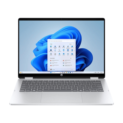 No image available
A 14-inch 2-in-1 for viewing maps and documents in a compact workspace, with the flexibility to switch between different modes.
Touchscreen with a 360° hinge, OLED screen with 1920 × 1200 pixels and a 16:10 aspect ratio, 16 GB of memory, 512 GB SSD and a quoted weight of 1.62 kg. A USB-C Power Delivery charger of at least 45 W is required but isn’t included. Check separately whether your preferred pen is supported.
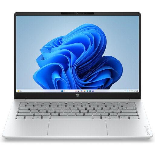 No image available
A 14-inch Windows laptop for viewing maps and web pages, or for assignments that require Windows.
AMD Ryzen 5 7520U, 8 GB of memory, 512 GB SSD and Windows 11 Home. The IPS screen has an anti-glare finish, a resolution of 1920 × 1200 and a 16:10 aspect ratio. The quoted weight is approximately 1.42 kg. No charger is included.
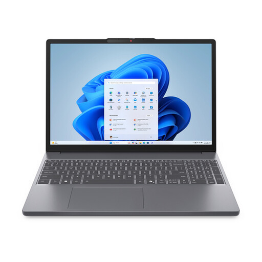 No image available
The 15.3-inch screen gives you more room to view maps and notes side by side. Bear the larger size in mind when carrying it around.
AMD Ryzen 7 8840HS, 16 GB of memory, 512 GB SSD and a QWERTY keyboard. The WUXGA IPS screen has a resolution of 1920 × 1200 and a 16:10 aspect ratio; Windows 11 Home is listed. The charger must be purchased separately.
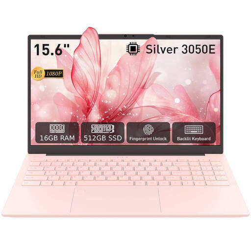 No image available
A laptop with a 15.6-inch screen for viewing map details on a larger display.
The FHD IPS screen has a resolution of 1920 × 1080. The product title lists 16 GB of DDR4 memory, a 512 GB SSD and a 3050E processor.
 No image available
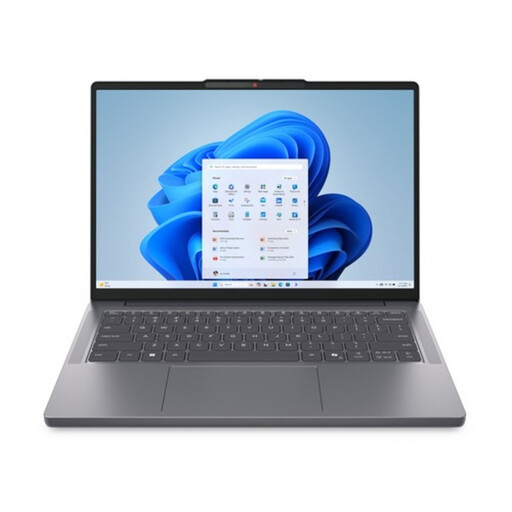
A 14-inch laptop for anyone looking for a more compact screen without sacrificing space for maps and study software.
AMD Ryzen 7 8840HS, 16 GB of DDR5 memory and a 1 TB PCIe SSD. The WUXGA IPS screen has a resolution of 1920 × 1200, with a quoted brightness of 300 nits. Windows 11 Home is listed and the quoted weight is 1.39 kg.
Not for every mapping task. QGIS lists Windows and macOS among its supported operating systems. If your course requires you to install ArcGIS Pro locally, Esri lists supported Windows versions; check the requirements for the version you’ll be using.
QGIS describes an Offline Editing feature that copies selected data to a GeoPackage or SpatiaLite database in advance and can synchronise changes later. Set up your project and the data you need while you’re connected; don’t assume that every online map layer will be available offline.
No, not by itself. Check that the exact laptop model supports your preferred pen standard and whether a pen is included. HP specifies MPP 2.0 support as a requirement for the active pen in question.
ACM ConsuWijzer says that, in most cases, online purchases come with a statutory cooling-off period of up to 14 days after delivery, although exceptions may apply depending on the purchase. You’re also covered by the statutory guarantee if a product doesn’t perform as you could reasonably expect under normal use; this isn’t automatically limited to a two-year manufacturer’s warranty.