
Student creating their own heatmaps
You’re processing point data in QGIS. The permitted software, the size of your dataset and the space on your screen all matter. QGIS documents a heatmap function based on kernel density estimation.


Start with the software: for local use of ArcGIS Pro, you’ll need a suitable Windows laptop, while QGIS is available on both Windows and macOS, and some tasks can be completed entirely in a browser. Then measure the space available on your desk and weigh it against the screen space you need for the map, legend and study notes.
You’re processing point data in QGIS. The permitted software, the size of your dataset and the space on your screen all matter. QGIS documents a heatmap function based on kernel density estimation.
You need to use prescribed desktop software locally, so first check the required version and operating system. For ArcGIS Pro 3.7, Esri lists 64-bit Windows 11 as a supported desktop operating system.
You mainly view or edit online maps. A compact laptop for browser use is only an option if your course doesn’t require local GIS software; ArcGIS Online describes heatmaps for point layers.
A good fit when: your course requires local use of ArcGIS Pro; check the exact version and Esri’s system requirements.
Trade-off: a compact model takes up less space, but screen space and specifications vary between configurations.
A good fit when: QGIS is permitted and you’re creating a heatmap from point data. QGIS is available for Windows and macOS.
Trade-off: the capacity you need depends on your data and other open programmes; there’s no universal RAM threshold for this task.
A good fit when: the task is limited to maps in an accessible web environment and the online features you’re allowed to use.
Trade-off: an online heatmap feature doesn’t mean that prescribed desktop software or course files will work on a Chromebook.
First, check which software your course actually requires. The percentages below give a general indication of priorities for this study task.
| What to consider | What should you check? | Who is this most important for? |
|---|---|---|
| Compatibility with GIS software | Check which application and version you need, then compare the operating system and the requirements for memory, storage and graphics capabilities. | If your course requires local GIS software, you’ll want to know it works on the laptop before choosing a size. Around 36% of consumers prioritise software compatibility. |
| A small desk and a readable map | Measure the available space and compare the laptop’s dimensions; check the screen size and resolution of the exact configuration. | If you want to view the map, legend and study notes together without filling your desk, screen space matters. Around 29% of consumers prioritise desk space and map readability. |
| Enough for browser-based work | Check whether your course uses the required web environment and map features, and whether it requires a local installation or specific files. | If you can complete tasks entirely online, there’s no need to prioritise a desktop installation unnecessarily. Around 21% of consumers make browser-based work their top priority. |
| Portability and connections | Compare the weight, the display connections you need, the keyboard layout and whether the required power adapter is included. | If you study in different places, portability, power and connections all matter when choosing. Around 14% of consumers prioritise mobile use. |
A heatmap in ArcGIS Online is different from working locally in QGIS or ArcGIS Pro. Being able to open an online map doesn’t confirm that desktop software or course files will work on the device.
Before you buy, confirm which software and web environment your course allows.
If your course requires desktop GIS, you may still need access to another computer.
A laptop may fit on your desk but still leave little usable space to view the map, legend and text together.
Compare the laptop’s dimensions and screen resolution. Also check the connections if you want to use an external display.
Apple’s stated battery life is based on specified video and internet activities, not on a GIS workload.
When comparing battery-life figures, check which activity was tested and don’t treat the result as a measure of GIS battery life.
According to ACM ConsuWijzer, statutory protection for a faulty product is in addition to any guarantee from the retailer or manufacturer.
Compare any extra cover with the rights you already have against the retailer.
The Vivobook 14 M1407 range is a compact Windows option for local study software.
The Dutch ThinkPad X13 Gen 7 configuration is a compact Windows laptop with a 13.3-inch screen.
The OmniBook X Flip 14-kc0600ndx is a 14-inch Windows model with a touchscreen.
The 13-inch MacBook Air with M5 is a compact macOS option if your course allows QGIS or suitable browser-based work.
The Chromebook Plus 514 CB514-6HT-32PZ is a compact ChromeOS option for tasks that can be completed in a browser.
These Joybuy options include compact Windows laptops for studying and map work; for a local GIS task, always check the exact software requirements.
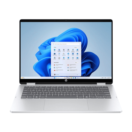 Image unavailable
This configuration could suit a compact Windows workspace; check that its specifications meet your course’s software requirements.
The memory is onboard and can’t be upgraded. The charger isn’t included.
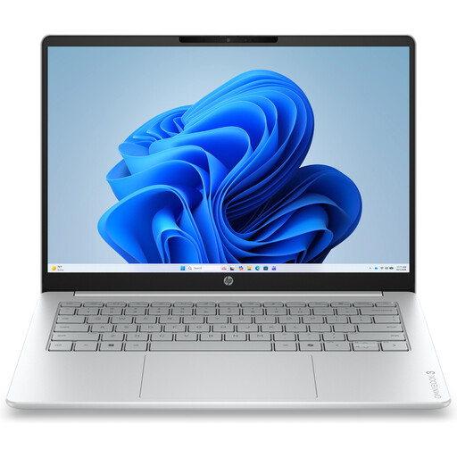 Image unavailable
This compact Windows model could suit studying at a small workstation; first check which GIS software you need.
The product name lists AMD Ryzen 5 7520U, 8 GB of RAM, a 512 GB SSD and Windows 11 Home. The memory is onboard and can’t be upgraded.
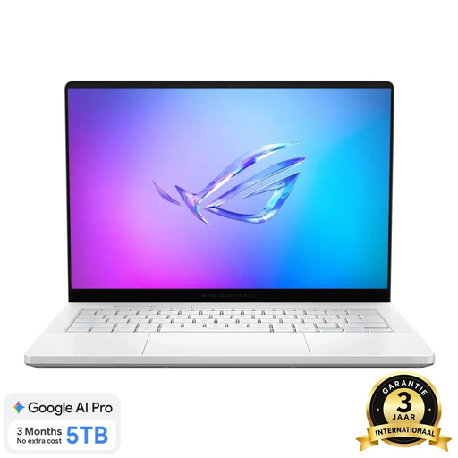 Image unavailable
Consider this compact Windows laptop only after comparing your course requirements with the exact configuration.
The product name lists Ryzen 9 270, RTX 5060, 16 GB of memory, a 1 TB SSD and a QWERTY keyboard. The memory is onboard and can’t be upgraded by the user.
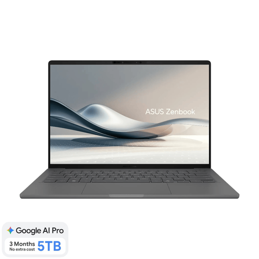 Image unavailable
This Windows model is worth comparing for a small workspace; check specialist software compatibility in advance.
The product name lists Snapdragon X, 16 GB of RAM, a 512 GB SSD, WUXGA OLED and a Dutch QWERTY keyboard. A compatible 65 W USB-C Power Delivery charger isn’t included; compatibility with specialist software may vary.
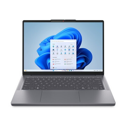 Image unavailable
This configuration could suit studying at a compact Windows workstation; compare its specifications with your course requirements.
The product name lists R7, 16G, 512G, 11H and a QWERTY keyboard.
Not as a directly supported installation of ArcGIS Pro 3.7: Esri lists supported Windows operating systems. Check with your course which working environment is permitted; QGIS for macOS is a different application, not an automatic replacement.
You can’t tell from the word ‘heatmap’ alone. Distinguish between viewing online maps, creating a heatmap in QGIS and running local ArcGIS Pro projects; check the task requirements and the version of the software you’ll use.
First, check that your data includes a suitable point layer. The QGIS Heatmap (kernel density estimation) function uses it to create a density raster; the search radius you choose affects how the map looks.
According to ACM ConsuWijzer, online purchases generally come with a cooling-off period of up to and including 14 days after delivery, with some exceptions. If a product is faulty, the retailer is also responsible for statutory protection; this isn’t automatically limited to the length of the manufacturer’s warranty.