
Studio scanning maps up to A3
Wants to capture larger, sufficiently sturdy maps in a single pass. Compare the stated scan area with the map size: Plustek and Microtek describe A3 flatbed models with their own scan-area dimensions.


First, measure the largest map you want to scan in a single pass. An A4 flatbed is only suitable for smaller originals, while an A3 flatbed gives you more room, although it still has a maximum scan size. Then choose according to the condition of the map. For a fragile or curled original, contactless or specialist digitisation may be more suitable. If the scanner will be shared, it’s also important to agree on software, settings and quality checks: a high dpi rating alone doesn’t tell you whether a scan is geometrically accurate.
Wants to capture larger, sufficiently sturdy maps in a single pass. Compare the stated scan area with the map size: Plustek and Microtek describe A3 flatbed models with their own scan-area dimensions.
Wants to establish in advance whether it’s safe to place the map on glass and whether using the lid is appropriate. The scanning guidance from the University of Antwerp and Metamorfoze offers advice on digitisation and preservation.
Wants to coordinate scans and settings between users for detailed or geometric assessment. Check the software capabilities of the exact model, and agree on file formats and quality checks.
| Consideration | What to look for when buying | Who is this most relevant to? |
|---|---|---|
| Scan area and map size | Measure the map, including any margins you want to capture, and compare it with the scan area of the exact model. | I want to capture a map in a single pass rather than rely on multiple scans. Around 33% of consumers consider scan area and map size their primary concern. |
| Safe handling | Assess each original to determine whether contact with the glass, positioning and, if applicable, use of the lid are appropriate. Don’t force the map to lie flat. | If the map is fragile or curled, I want to prevent damage from contact or pressure. Around 27% of consumers put safe handling first. |
| Image fidelity | Decide whether your aim is readability or accurate further processing. Assess distortion and visible information as well as detail. | For map research, I want relevant details and proportions to remain usable. Around 20% of consumers say image fidelity is their main purchasing concern. |
| Shared workflow | Check compatibility and software for the studio computers, and agree on settings, file names and scan checks. | When several people use the scanner, I want a workflow that everyone can follow. Around 20% of consumers give shared use the highest priority. |
A map larger than the scan area won’t fit in a single pass. Combining multiple scans requires extra care, as geometric distortion can affect further processing. The University of Antwerp highlights avoiding geometric distortion as an important consideration when digitising maps.
Measure the map and compare it with the scan area of the exact model. Also assess a test scan of a representative original.
Combining multiple scans can take extra time and require additional checks.
A flatbed scanner requires the map to be placed on the glass. Contact with the glass or lid isn’t appropriate for every fragile original.
Let the condition of the map determine how you scan it. If necessary, opt for contactless or specialist digitisation, and don’t force the original to lie flat.
A product listing or price published previously doesn’t confirm that the exact model is currently available.
Check the current availability and terms on the product page for the exact model just before ordering.
Plustek describes the OpticPro A320E as an A3 flatbed scanner with a CCD sensor, scan profiles and TWAIN/WIA integration.
Microtek describes the ScanMaker 9800XL Plus as an A3 flatbed scanner with a reflective scan area of 304,8 × 429,26 mm and software options for a controlled scanning workflow.
Canon describes the CanoScan LiDE 400 as a compact A4 flatbed scanner powered via USB-C, suitable for smaller maps and documents.
This product selection is aimed at smaller maps that may be suitable for an A4 flatbed scanner. Before buying, check that the map fits within the usable scan area of the exact model.
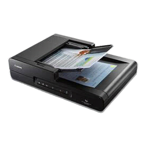 No image available
Suitable for smaller maps that fit within A4 and for which you want to use a flatbed scanner.
A4 flatbed and ADF scanner; stated resolution: 600 × 600 DPI.
No, a higher dpi rating alone isn’t enough. Decide what you need the scan for, and check distortion, lighting and visible information as well as detail. Metamorfoze’s quality guidelines are intended for digitisation under that programme and aren’t automatically a requirement for every studio.
Before buying, check that the connection and scanning software are compatible with the studio computers. Then document the settings, file names and scan checks for all users. The stated capabilities of the models don’t automatically confirm full network functionality.
This depends in part on who is buying and the main purpose of the contract. ACM ConsuWijzer explains that consumer protection doesn’t apply when a contract is used mainly or exclusively for business purposes. For a business purchase, check the applicable sales and service terms.
Not simply because a map is old or because you scanned it yourself. Check the rights to the specific map and the intended use. The Dutch government distinguishes between personal use and distributing or publishing protected work. For scans provided by the National Archives, the stated download and rights markings indicate whether they may be freely reused.