
Scanning large maps
You want to avoid cutting off map edges, legends or folds in an atlas. Measure the entire original and compare its dimensions with the scanning area; A3 and A2 require different scanning approaches.


First, measure the largest map or the fully opened atlas, then compare those dimensions with the scanning area of the exact scanner model. A compact overhead scanner may suit maps up to A3 and originals you’d rather not place on a glass platen. Larger maps need a bigger scanning area, while an A4 flatbed is only suitable for smaller originals that can safely lie on glass. If you’re scanning for research or reproduction, also check the results for detail, distortion and colour. A single model specification doesn’t prove that the scan meets heritage-quality standards.
You want to avoid cutting off map edges, legends or folds in an atlas. Measure the entire original and compare its dimensions with the scanning area; A3 and A2 require different scanning approaches.
You want to capture a historical map without forcing a binding open or touching a fragile surface unnecessarily. The condition of the original will help determine whether an overhead setup is suitable. Metamorfoze lists maps as examples of originals that may benefit from preservation imaging.
You want to be able to put the scanner away after a session, as long as its scanning area is large enough for the map. A compact A3 model and a larger professional setup require different workspace arrangements.
Suitable for: maps and atlas sections that are confirmed to fit within the scanning area of the model you choose, especially if you’d rather capture the original from above.
Trade-off: A3 is the limit for this option. Take a test scan to check legibility, distortion and colour, too.
Suitable for: smaller maps or pages that can lie on the glass platen without harmful pressure.
Trade-off: the scanning area may be too small for larger maps, and scanning requires contact with glass.
Suitable for: maps larger than A3, fragile bindings or projects where a verifiable scanning process is important.
Trade-off: check the space required and the exact model. For occasional use, facilities at the National Archives or a reproduction from the KB may be an alternative.
| What to consider | What should you check? | Who is this most important for? |
|---|---|---|
| Full map size | Measure the largest map and the opened atlas, including the legend and edges; compare both dimensions with the scanning area of the exact model. | If I want to capture the whole map in one scan, the full size must fit. That’s why around 33% of consumers put map size first. |
| Preserving the original | Assess the paper, pigment and binding; check whether the original can safely lie on glass or needs support. | With a fragile map or binding, I want to avoid unnecessary pressure and handling, even if that limits my options. Around 27% of consumers put preserving the original first. |
| Detail and colour | Take a test scan of fine text and relevant colours; check the edges, distortion and file output for your intended use. | If small place names and coloured markings need to remain legible, I want to be able to assess the saved image myself. That’s why around 20% of consumers prioritise detail and colour checks. |
| Shared desk | Check the setup with the map fully laid out, along with the connections, controls and arrangements for the computer and file storage. | When several people use the same workspace, I want to be able to put the scanner away and repeat the process consistently. Around 20% of consumers make shared workspace their main consideration. |
Compact overhead models with an A3 scanning area may be too small for a larger map. Scanning in sections takes extra work, and stitching the images together can be more difficult.
Before you buy, measure the largest complete original and decide whether scanning in sections would be acceptable for your needs.
A stated resolution doesn’t automatically tell you how much detail, distortion or colour accuracy the final scan will have. Metamorfoze defines different quality levels according to the purpose of digitisation.
Take a test scan of a representative map and check fine text, relevant colours and edges before settling on a process.
An A4 scanning area may not be big enough for a larger map. A flatbed also uses a glass platen, which means handling the original differently from an overhead scan.
Let the map’s or binding’s dimensions and condition determine whether it’s suitable to place on glass.
The IRIScan Desk 7 Pro is a compact overhead scanner for documents and books up to A3, as stated on the Dutch product page.
The ET series consists of overhead book scanners, with the manufacturer listing the ET24 Pro among its A3 models.
The OpticBook 4800 is a flatbed book scanner for smaller pages and originals that can safely be placed on glass.
The OS 16000 series offers a professional overhead scanning option for maps and bound material within the stated scanning area.
According to Ricoh, the SV600 is a contactless overhead scanner for books, images and documents up to A3.
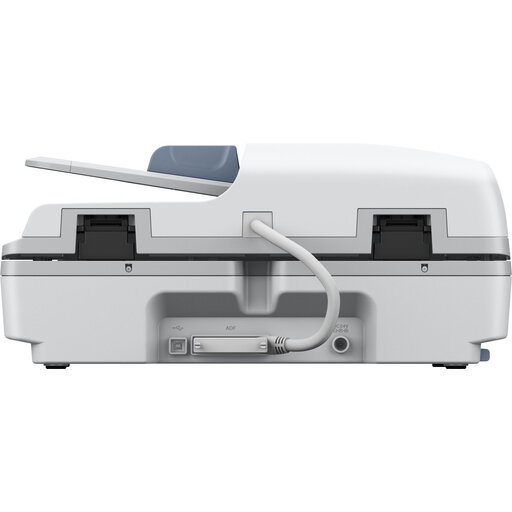
This selection includes a foldable A3 document camera for flat sheets and a flatbed scanner that supports sizes up to A4. Compare the scanning area with the full map and check that the scanning method you choose is suitable for the original.
 No image available
Suitable for flat originals within the stated A3 size that need a foldable scanner setup.
8 MP CMOS sensor and OCR. Foldable design; compatible with Windows and macOS. The product information advises against scanning glossy materials.
 No image available
A flatbed option for maps that can safely lie on glass and fit within the supported size.
The product information lists A4, A5, A6 and B5. The network interface panel for shared use is described as optional, so check which model and accessories are included.
Measure the entire area you want to capture, including the legend and edges, then compare both dimensions with the scanning area of the exact model. According to Plustek Europe, the Plustek OpticBook 4800 has a scanning area of 216 × 297 mm; the Dutch product page for the IRIScan Desk 7 Pro lists A3. So don’t rely on the term ‘book scanner’ alone.
Agree where the map will be supported, which computer and software will be used, and where the files will be saved. After setting up again, take a test scan and check that the map is sharp and straight, with no edges missing.
Not always. The National Archives describes how to digitise material using a professional book scanner in its reading room. The KB also offers scans on request and distinguishes these from high-quality reproductions. Ask the relevant institution about access, terms and suitability for your map.
According to the Dutch government, there is no fixed statutory warranty period in the Netherlands, but you are entitled to a product that meets the terms of your agreement. A manufacturer’s or extended warranty is additional; if a product is faulty, contact the seller.
That depends on the rights attached to the specific map and any terms set by the collection manager. The Dutch government distinguishes between a copy of copyright-protected material for personal use at home and distributing or publishing it. Don’t assume that a map is free to publish just because it’s old; check the rights first.