
Local map researcher
You want to explore downloaded heat and neighbourhood data as map layers, and choose a computer to suit your GIS software and the size of your projects.


Choose a desktop based on the mapping software you use and the size of the files you want to open or edit yourself, rather than simply opting for the most powerful graphics card. A compact desktop may suit viewing maps and working on smaller local projects; for larger files, storage, memory and upgrade options are important considerations. Esri lists the Windows operating systems supported by ArcGIS Pro 3.7, while QGIS offers installation options for Windows, macOS and Linux, among others.
You want to explore downloaded heat and neighbourhood data as map layers, and choose a computer to suit your GIS software and the size of your projects.
You compare neighbourhoods and map layers, and also use documents or a small amount of locally stored material. You don’t want to choose a more powerful set-up without a good reason.
You have limited desk space or already own a monitor, so you consider the desktop’s size, its connections and any extras you might need.
A good fit if: you mainly view map layers, make notes and store few files locally.
Bear in mind: check the connections for your monitor and what storage is included with the specific configuration.
A good fit if: you process map layers locally or are considering ArcGIS Pro; check the requirements for the version you plan to use.
Bear in mind: a tower takes up more space than a mini PC, and ArcGIS Pro requirements won’t necessarily apply if you only view maps.
A good fit if: you use GIS software that runs on macOS and already have suitable monitors and accessories.
Bear in mind: Esri lists the Windows operating systems supported by ArcGIS Pro 3.7, so don’t assume it offers direct macOS support.
| Consideration | What to look for | Who should pay particular attention? |
|---|---|---|
| Software compatibility | Decide whether you’ll use a viewer, QGIS or ArcGIS Pro, then check the requirements for the right version. | If I need a particular GIS programme, I want to know first whether it works on the operating system I’ve chosen. Around 40% of consumers put software compatibility first. |
| Local files | Check the size of your downloads and compare it with the SSD capacity and any upgrade options for the exact configuration. | When I edit map layers locally, I want room for my files and projects. Around 30% of consumers give local storage and processing capacity top priority. |
| Workspace and monitors | Compare the video connections with your monitors and check which accessories are included. | If I have limited desk space or already own a monitor, I want to know whether the size and connections will suit my workspace. Around 20% of consumers base their choice mainly on these factors. |
| Complete set-up and service | Only include the monitors and accessories you need, and check any additional service terms separately. | If I still need equipment to complete my workspace, I want to include it in my comparison and understand the service terms. Around 10% of consumers put the complete set-up and service first. |
QGIS lists installation options for several operating systems, while Esri’s requirements for ArcGIS Pro 3.7 specify supported Windows systems. The storage and memory you need will depend on your own files, software and projects: there isn’t one configuration requirement that suits every map reader.
Esri lists the Windows operating systems supported by ArcGIS Pro 3.7. QGIS also offers installation options for macOS, but that doesn’t mean every GIS programme will work on that operating system.
Before you buy, decide which programme and version you need. Then check that software’s operating system requirements.
Lenovo states that monitors for the ThinkCentre Tiny range are sold separately; what’s included may vary by configuration.
Check the contents and connections of the exact configuration, and compare them with your monitor and any other equipment you need.
In March 2026, the Climate Impact Atlas announced that the Night-time Heat map was being added and the Warm Nights map removed. Map layers can change over time.
When you download maps, keep a note of the map name and description, and check for updates to the Climate Impact Atlas before comparing neighbourhoods or results.
HP offers slim desktops as well as tower models, giving you options to compare for a compact workspace or if you need a desktop case.
The ThinkCentre M70q Gen 5 Tiny is a compact Windows desktop to consider if size and serviceability are important to you.
The Mac mini is a compact option for an existing macOS workspace, provided your software runs on macOS.
The Dell Pro Tower QCT1250 is a tower to compare if you want to tailor a configuration to your software and projects.
This selection includes compact desktops and Mac mini configurations for viewing maps, working with local files and setting up an existing macOS workspace. For each configuration, check that the operating system, software and specifications suit your projects.
 No image available
A compact Windows desktop to consider for viewing maps or light study; check the requirements of the GIS software you plan to use.
Windows 11, 8 GB DDR4 memory and a 256 GB SSD. The product name also lists Bluetooth 5.2 and Wi-Fi 5.
 No image available
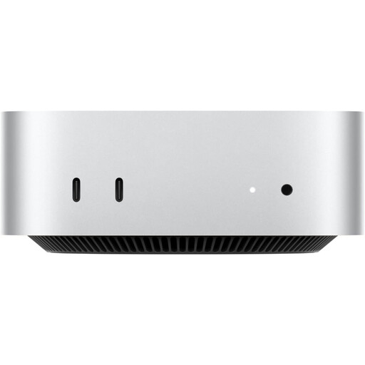
A good fit for a compact macOS workspace if your chosen GIS software supports macOS; QGIS offers a macOS installation option.
Apple M6 chip with 12-core CPU and 12-core GPU, 16 GB memory and a 256 GB SSD. Check that the storage will accommodate your local map files.
No image available
A good fit for a compact macOS workspace if your chosen GIS software supports macOS; QGIS offers a macOS installation option.
Apple M6 chip with 12-core CPU and 12-core GPU, 16 GB memory and a 512 GB SSD. Check that the configuration suits your software and projects.
No image available
A good fit for a compact macOS workspace if your chosen GIS software supports macOS; check the requirements for the specific software version.
Apple M6 chip with 12-core CPU and 12-core GPU, 24 GB memory and a 512 GB SSD. These specifications describe the configuration, not its performance in a specific GIS project.
 No image available
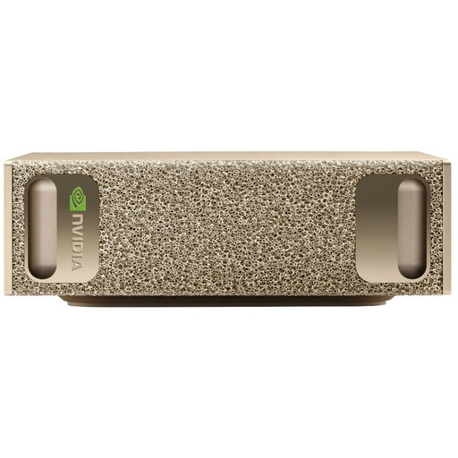
Before buying, check that the operating system listed is supported by the software you need for studying maps.
The product information lists an NVIDIA GB10 processor, NVIDIA DGX OS, 128 GB RAM and a 4 TB SSD. These specifications alone don’t measure GIS performance.
No, that doesn’t necessarily follow from how you plan to use the maps. First decide whether you’ll simply view them in a viewer or open files locally in GIS software. QGIS offers installation options for several desktop operating systems; for ArcGIS Pro, check the requirements for the version you need.
When you download material, keep a note of the map name and description, and check for updates to the Climate Impact Atlas. The Climate Impact Atlas announced that the Night-time Heat map was added and the Warm Nights map removed in March 2026; in August 2026, the Urban Heat Island map was also removed.
Check what’s included with the exact configuration. Lenovo states that monitors for the ThinkCentre Tiny range are sold separately; also check that the connections are compatible with your own monitor.
According to ACM ConsuWijzer, you have a statutory guarantee in addition to any guarantee offered by the seller or manufacturer. If a product doesn’t perform as you could reasonably expect under normal use, the seller must provide an appropriate remedy free of charge. For online consumer purchases, ACM says you often have up to 14 days from delivery to change your mind; check which exceptions apply.