
GIS student working with coastal maps
You want to study measurements and maps side by side. Choose based on your GIS software’s requirements; Rijkswaterstaat measures the coastline every year and also publishes the JARKUS series.


Start with the GIS software required for your course or project. QGIS can be installed on Windows and macOS, while Esri lists Windows as a supported operating system for ArcGIS Pro 3.7. Then decide whether you want to keep paper notes or create new digital handwritten notes. A desktop doesn’t automatically support pen input, and a compact PC offers less room for future upgrades than a tower.
You want to study measurements and maps side by side. Choose based on your GIS software’s requirements; Rijkswaterstaat measures the coastline every year and also publishes the JARKUS series.
You want to refer to paper notes or capture new handwriting digitally. Microsoft describes digital pen input and conversion, but that doesn’t mean every desktop has built-in pen functionality.
You’re looking for a dedicated space for map work and comparing a compact desktop with a tower. Factor in your monitors and any peripherals you may still need when planning your setup.
A good fit if: you want to use ArcGIS Pro or need Windows software, and have limited desk space.
Bear in mind: check the exact configuration and don’t assume pen input or all peripherals are included.
A good fit if: the option to upgrade memory or storage matters more than having a small computer case.
Bear in mind: check the expansion options and graphics configuration of the specific model. The word ‘tower’ alone says nothing about GIS performance.
A good fit if: you want to use macOS and your research software is available for it; QGIS offers a macOS installation.
Bear in mind: Esri lists Windows, not macOS, as a supported operating system for ArcGIS Pro 3.7. Also consider how much storage you need for your own files.
| What to consider | What should you check? | Who is this important for? |
|---|---|---|
| GIS software | Check the operating system and the full requirements for the exact software version. Esri warns that meeting the minimum requirements doesn’t automatically guarantee good performance. | If I want to analyse maps, my chosen software needs to run on the desktop. Around 36% of consumers say GIS software compatibility is their main buying concern. |
| Handwritten sources | Distinguish between keeping paper, writing new digital ink and converting handwriting to text. For digital ink, check the device, app and language you need. | If I want to keep referring to notes or write digitally, I want to know in advance which input method I’ll need. Around 29% of consumers prioritise handwritten sources. |
| Local storage | Estimate how much space you’ll need for your own maps and source files, then compare this with the SSD capacity of the chosen configuration. | If I want to keep maps and references locally, I need enough space for my own files. Around 21% of consumers name storage capacity as their main buying concern. |
| Workspace setup | Check the ports, monitors and input devices included with the exact configuration. A keyboard and mouse aren’t listed for the Lenovo configuration reviewed. | If I’m setting up a dedicated space for map work, I want to know what I already have and what else I need. Around 14% of consumers focus mainly on whether their workspace is complete. |
The Microsoft features described are for digital ink. That isn’t the same as scanning existing paper notes and automatically converting them into readable text.
First decide whether you want to keep paper, write new digital notes or use text recognition. Then check that your chosen app and input method support the specific task.
QGIS offers a macOS installation, but Esri lists Windows as a supported operating system for ArcGIS Pro 3.7.
Check which programmes your course or project actually requires before choosing an operating system.
A compact computer case doesn’t automatically mean a monitor and input devices are included. A keyboard and mouse aren’t listed for the Lenovo configuration reviewed.
Compare what’s included with the exact configuration against the monitors and devices you already have.
In the Netherlands, statutory consumer protection doesn’t have a fixed legal time limit. A manufacturer’s warranty is an additional promise and doesn’t replace your statutory rights.
Keep your proof of purchase and contact the seller if a consumer product is faulty.
The ThinkCentre Neo 50q Gen 5 is a compact Windows option to consider for a small map-work setup.
The ProDesk 4 Mini G1i is a compact Windows option; the ProDesk 4 Tower G1i is an alternative worth exploring if upgradability matters to you.
The Mac mini is a compact macOS option if your chosen research software runs on it.
The Dell Pro Micro QCM1250 is a compact Windows option to compare based on its exact configuration.
This selection includes compact Windows desktops, Windows PCs with dedicated graphics cards, and Mac mini models for software that runs on macOS. Check your project’s software requirements, storage needs and workspace setup before choosing a configuration.
 No image available
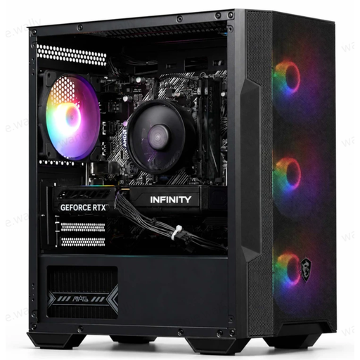
A compact Windows 11 mini PC to consider if desk space is limited. Check your software’s GIS requirements before choosing this configuration.
The title lists 8 GB DDR4 and a 256 GB SATA SSD. The processor variant is listed as Intel Core i5 8250U/8350U.
 No image available
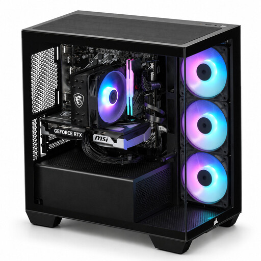
This Windows desktop lists a dedicated graphics card. Compare the full configuration with your GIS software’s requirements rather than focusing on the graphics card alone.
The title lists 16 GB RAM, a 480 GB SSD and Windows 11, which is not activated.
 No image available
A Windows 11 Home desktop with a dedicated graphics card to consider if your project has specific graphics requirements. Check the requirements of the software you’ll be using.
The title lists 16 GB DDR4 RAM, a 480 GB NVMe PCIe SSD and Windows 11 Home, which is not activated.
 No image available
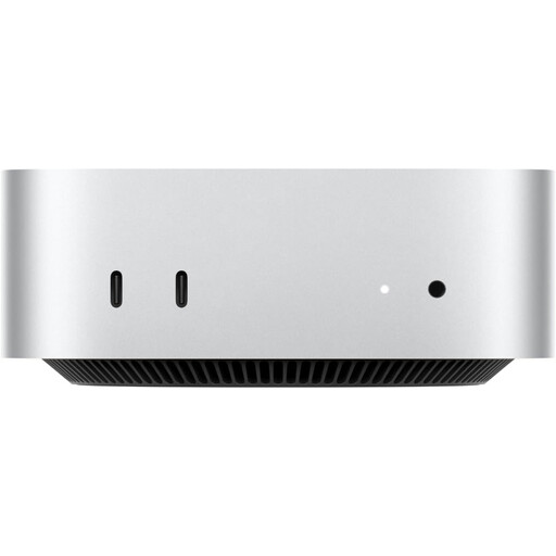
A compact macOS option if your research software runs on macOS; QGIS offers a macOS installation. Esri lists Windows for ArcGIS Pro 3.7.
The product title lists an M6 chip with a 12-core CPU and 12-core GPU, 16 GB memory and a 256 GB SSD.
No image available
A compact macOS option if your research software runs on macOS; QGIS offers a macOS installation. Esri lists Windows for ArcGIS Pro 3.7.
The product title lists an M6 chip with a 12-core CPU and 12-core GPU, 16 GB memory and a 512 GB SSD.
Not for all mapping software: QGIS also offers a macOS installation. If you want to run ArcGIS Pro 3.7 locally, Esri lists Windows as a supported operating system. Check the full requirements for that version too.
No, not without the right input method and software. Microsoft describes writing with digital ink and converting it; the Ink to Text Pen requires a digital pen and a supported environment. The feature described doesn’t confirm that scans of existing paper notes can be converted in the same way.
First decide which map or measurement series and software you’ll use. Rijkswaterstaat describes annual coastline measurements; the JARKUS catalogue contains annual files and notes that .jrk files can be viewed in Morphan. Choose your storage based on your own files and workflow.
For a consumer purchase in the Netherlands, statutory protection has no fixed legal time limit, and the seller is your point of contact if a product is faulty. For distance purchases, you’ll often have a 14-day cooling-off period, subject to exceptions and conditions.
It depends on the data and the context. The Dutch Data Protection Authority distinguishes between processing for purely personal or household use and other processing of personal data. Where the GDPR applies, a lawful basis and appropriate security are among the relevant requirements.