
Teacher with large, loose maps
If you’d prefer to capture a map in one scan, compare the width and length of the scan area. Canon Netherlands and Plustek Europe list the dimensions of their A4 and A3 flatbed models.


Start by measuring your largest map. An A4 flatbed scanner is suitable if the map fits within the specified scan area, while an A3 model can scan larger originals in one go if they fit within its scan area. Then choose between a compact USB model for one workstation and a network model for shared use. If the maps are protected material, check the conditions for scanning and sharing separately.
If you’d prefer to capture a map in one scan, compare the width and length of the scan area. Canon Netherlands and Plustek Europe list the dimensions of their A4 and A3 flatbed models.
If you mainly scan maps or sections of maps up to A4 size, compare the scanner’s external dimensions with the space available on your desk. Epson says the Perfection V39II comes with a stand that lets you position the scanner flat or on its side.
If several teachers need to use the same scanner, check whether it can connect to the school network. Epson lists built-in network and Wi-Fi features for the WorkForce DS-51000WN.
First, check whether your largest map fits within the scan area. Then consider the space available, whether the scanner will be shared and how clearly it can capture small labels.
Choose this option: if you’re scanning maps that fit within 216 × 297 mm and will use the scanner at one workstation.
Bear in mind: larger maps won’t fit in a single scan and may need to be scanned in sections and stitched together.
Choose this option: if maps need to fit within 297 × 431.8 mm in one scan and you have a computer next to the scanner.
Bear in mind: according to Plustek, the OpticSlim 1180 measures 589 × 407 × 68 mm and uses USB 2.0 Type B.
Choose this option: if several teachers need the scanner and their maps fit within the A3 scan area.
Bear in mind: check that the network connection suits the school environment and that your chosen model is available.
| What to consider | What should you check? | Who is this important for? |
|---|---|---|
| Scanning the whole map in one go | Measure the width and length. Canon Netherlands specifies a maximum of 216 × 297 mm for the LiDE 400; Plustek Europe lists a maximum of 297 × 431.8 mm for the OpticSlim 1180. | If I want to capture a large, loose map in a single file, I check that both dimensions fit within the scan area. Around 40% of consumers prioritise being able to fit the whole map. |
| Setting up in a small classroom | Compare the scanner’s external dimensions with the space available on your desk, and consider where you’ll store it when it’s not in use. Canon Netherlands lists the LiDE 400 as 250 × 367 × 42 mm; Plustek Europe lists the OpticSlim 1180 as 589 × 407 × 68 mm. | If you need to fit or store a scanner in a small workspace, you’ll want to make sure it fits the space available. Around 30% of consumers prioritise a compact setup. |
| Use by several teachers | Check how users will access the scanner and whether its connection is compatible with the school computer or network. Epson lists built-in network and Wi-Fi features for the WorkForce DS-51000WN; according to Plustek, the OpticSlim 1180 has USB 2.0 Type B. | If several teachers need scans, I want to know in advance how they can use the scanner and receive the files. Around 20% of consumers give shared access top priority. |
| Small labels and symbols | Compare optical resolutions on a like-for-like basis and, if possible, look at a sample scan. Canon Netherlands specifies 4800 × 4800 dpi for the LiDE 400; Plustek Europe lists an optical resolution of 1200 dpi for the OpticSlim 1180. | If you need to read small place names or symbols, assess the scan output rather than relying on a dpi figure alone. Around 10% of consumers prioritise detail. |
Whether a map fits in one scan depends on both the width and length of the specified scan area.
Measure your largest map and compare both dimensions with the specifications for the exact model.
If the map doesn’t fit in one scan, scanning it in sections and stitching them together can take extra time.
Manufacturers may list optical resolution and adjustable scan resolution separately. A high figure alone doesn’t confirm how clearly small map labels will appear.
Compare like-for-like figures and, if possible, make a sample scan of a map with small place names.
Conditions apply to the educational use and digital sharing of protected material.
Check the rights to the map and the relevant school policy before distributing a scan.
Permission or a fee may be required for protected material. The conditions depend on the material and how you intend to use it.
The CanoScan LiDE 400 is a compact A4 flatbed scanner for maps or map sections that fit within 216 × 297 mm. Canon Netherlands lists USB power and external dimensions of 250 × 367 × 42 mm.
According to Plustek Europe, the OpticSlim 1180 is an A3 flatbed scanner with a scan area of 297 × 431.8 mm and USB 2.0 Type B.
Epson offers a compact A4 option with the Perfection V39II, as well as a separate shared A3 network option with the WorkForce DS-51000WN. The features listed apply to these specific models.
Microtek describes the ScanMaker 9800XL Plus as an A3 scanner with an optical resolution of 1600 dpi.
These Joybuy picks are A4 flatbed scanners for maps that fit within the specified scan area. Before buying, compare the exact map dimensions and connections.
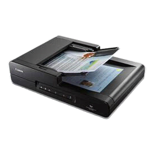 No image available
The flatbed is suitable for loose maps that fit within A4 size. Check your map’s dimensions before use.
The product name lists A4, 600 × 600 dpi and an automatic document feeder (ADF).
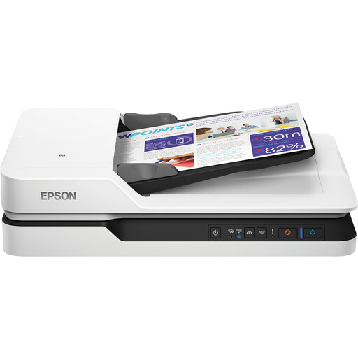 No image available
The A4 flatbed is suitable for loose maps that fit within the specified scan area. Check your map’s dimensions and the computer connection.
The product name lists A4 and 1200 × 1200 dpi. The product description lists Wi-Fi and USB 3.0.
Not in one scan if the map extends beyond the specified scan area. Canon Netherlands lists a maximum of 216 × 297 mm for the CanoScan LiDE 400. For larger maps, you’ll need a bigger scan area or several scans.
Check the scanner’s external dimensions, the clearance needed to open the lid, its connection and the computer that will run the scanning software. Plustek lists USB 2.0 Type B for the OpticSlim 1180. Check that this connection and the supported software are compatible with the school computer.
A larger scanner needs enough space, while a map that won’t fit in one scan may need to be scanned in sections and stitched together. Permission or a fee may be required for protected material. Check which rules apply to the map and your intended use.
Not automatically just because the school owns the printed map. According to Auteursrecht.nl, the Rijksoverheid and Onderwijs en auteursrecht, the use of protected material depends on the conditions and intended use. Check the rights and relevant school policy before sharing the scan.
Yes. If the scan contains pupils’ personal data, the school must apply the GDPR rules to its processing. The Autoriteit Persoonsgegevens describes, among other things, the accountability obligation and measures for protecting pupils’ data.